NOAA's Winter Outlook: Warmer North, Wetter South as a Record El Niño Takes Over
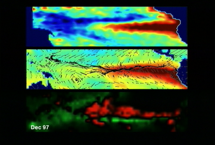
Photo: NASA Scientific Visualization Studio / Public domain · via Wikimedia Commons
NOAA's Winter Outlook: Warmer North, Wetter South as a Record El Niño Takes Over
NOAA's winter outlook lands: warm north, wet south
On Oct. 15, NOAA's Climate Prediction Center released its 2026-27 U.S. Winter Outlook, covering December 2026 through February 2027. Warmer-than-average temperatures are favored across the northern tier; wetter-than-average conditions are favored from California to Florida and along the Eastern Seaboard; and drought is expected to improve for most of the country.
41 states lean warm, and none lean cold
Part or all of 41 of the Lower 48 states are forecast to be warmer than normal, and no state — or even part of a state — is favored to be cooler than average. Florida, Louisiana, southern Georgia, Alabama and Mississippi look near normal, while Texas, New Mexico, Arizona, Utah, Southern California, Nevada, Wyoming, western Oklahoma, Kansas and Nebraska have equal chances of warm, cold or normal.
39 states lean wet as the storm track shifts south
Parts of all 39 states are forecast to see a wetter-than-usual winter, with much of Montana and parts of Oregon, Idaho, Wisconsin and Michigan drier. NOAA's precipitation map favors above-average totals from California to the south-central Rockies, the southern Plains, the Gulf Coast, the Southeast and the lower mid-Atlantic. Hawaii, much of Alaska, the northern Mountain West, some Great Lakes areas and the western Pacific Islands lean dry.
The jet stream slides south under a very strong El Niño
"As we know from decades of observations, a very strong El Niño will likely bring a southward and eastward shift to the jet stream for the contiguous U.S., which tilts the odds toward stormier weather across the South," National Weather Service director Ken Graham said. More rain and snow may bring drought relief, he added, but "too much precipitation on dry soil can fuel destructive flash floods and mudslides."
A steadier polar vortex means fewer Arctic outbreaks
NWS meteorologist and branch chief Jon Gottschalck said a powerful El Niño tends to build a stronger, more stable polar vortex, which favors fewer Arctic air outbreaks over the United States. Cold snaps and snowstorms are still possible, he said — just less likely.
Odds top 90% that this is the strongest El Niño since 1950
The Climate Prediction Center put the odds of a very strong event above 90% for fall and winter, and 75% — raised to 83% in October — that the October-December period outpaces every El Niño in the record back to 1950.
Drought relief in the Southwest, trouble in the Northwest
NOAA expects drought to improve or end in the Southwest, Southern Great Plains, Southeast and parts of the East Coast; Gottschalck added western Oregon and western Washington, the central and southern Rockies, the lower Mississippi Valley and areas in the East. Drought is favored to develop or worsen in parts of the northern Rockies, along with northeastern Oregon and eastern Washington.
Northern cities could see half their normal snow
NOAA does not project seasonal snowfall totals, since snow is generally not predictable more than a week ahead. Private forecaster AccuWeather expects Salt Lake City to be the only big metro area with above-normal snow, and puts Chicago, Boston, New York and Philadelphia at roughly half or less of normal. The Boston Globe noted that in the last super El Niño, 2015-16, every New England state finished below average — 10 to 30 inches short across Southern New England, and as much as 60 inches short in the northern mountains.
Snow, sleet and freezing rain may reach the Southeast
In the Southeast and parts of the southern Plains, El Niño's cooler and wetter setup could support snow, sleet and freezing rain, depending on how cold it gets and whether the cold air lines up with the storms. Gottschalck also warned that Florida and parts of the Southeast should be on guard for more tornadoes this winter and early spring; El Niño years average about 15 tornadoes a year in Florida, nearly twice the tally of neutral or La Niña years.
California faces a wet winter, and flood risk with it
The outlook puts the odds of above-normal precipitation at 50% to 60% from the Bay Area to the Mexican border, 40% to 50% north of the Bay Area and 33% to 40% in the state's northernmost strip. Forecasters warn frequent storms mean flood and landslide risk, alongside heavy Sierra Nevada snow.
Odds, not promises — and the next update lands Nov. 19
NOAA stresses that these are probabilities rather than guarantees, and the Climate Prediction Center will refresh the outlook on Nov. 19. Gottschalck noted that some southern storms may turn northeast along the East Coast, potentially bringing heavy rain and snow to Mid-Atlantic and Northeast cities: "These storms could be very strong."
Sources
- NOAA: El Nino looms large over U.S. Winter Outlook
- NBC News: US winter is likely to be wetter and warmer, forecasters say, and snow may shift south
- USA Today: Winter weather forecast released by NOAA for 2026-2027
- ABC News: NOAA forecasts a wet south and warmer north as El Nino impacts winter weather in the US
- CNN: Super El Nino will determine which parts of US get rain and snow this winter