Trudy Skirts Mexico's Pacific Coast, Shutting Manzanillo and Emptying Beaches
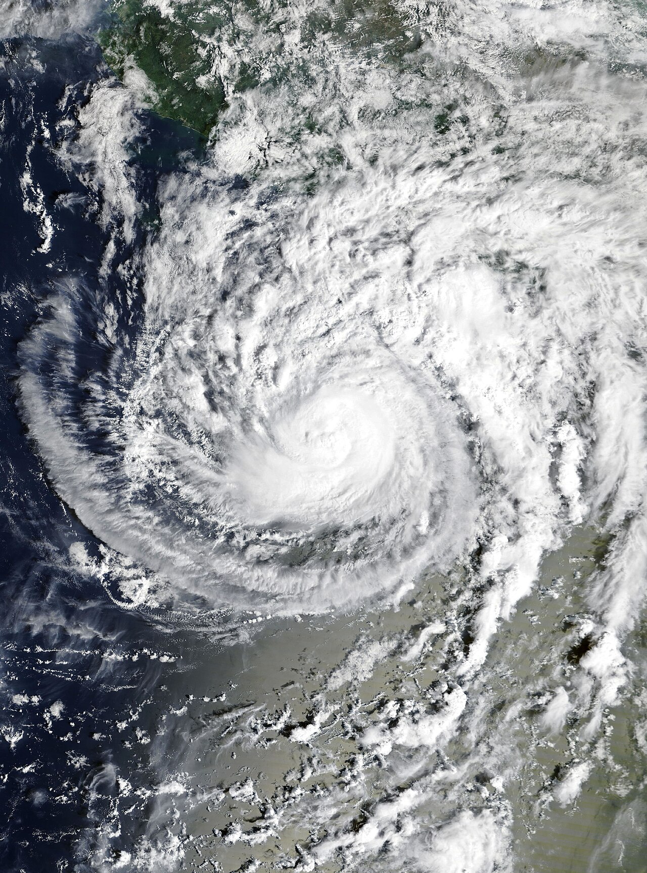
Photo: NASA (Public domain) · via Wikimedia Commons
Trudy Skirts Mexico's Pacific Coast, Shutting Manzanillo and Emptying Beaches
Category 2 storm hugs the coastline
Hurricane Trudy lashed parts of Mexico's southwestern and west-central Pacific coast with heavy rain and strong winds early Sunday, tracking parallel to the shore instead of coming ashore. The U.S. National Hurricane Center put the center near 18.6N, 106.3W at 0900 UTC, with maximum sustained winds of 105 mph (165 kph), a minimum central pressure of 970 mb and northwestward motion of about 10 mph (17 kph). Reuters reported the storm was about 150 miles (240 km) west of Manzanillo; the Associated Press placed it roughly 135 miles (215 km) south-southwest of Cabo Corrientes and 115 miles (185 km) west-southwest of Manzanillo. AP said the center stayed near the Mexican coast through Sunday evening.
Warning holds from Manzanillo to Cabo Corrientes
A hurricane warning remained in effect from Manzanillo in Colima state to Cabo Corrientes in Jalisco. A tropical storm warning stayed up for Las Islas Marias, while the warning from east of Punta San Telmo to Lazaro Cardenas was discontinued. Mexico's navy urged mariners and coastal residents to exercise extreme caution because of high waves, heavy rain, rising rivers, flooding and landslides in vulnerable areas.
Officials say the rain is the real threat
The hurricane center forecast 4 to 8 inches (10 to 20 cm) of rain through the weekend, with isolated totals around 12 inches (30 cm), along and near the coast in Michoacan, Colima and Jalisco; its Saturday advisory put the isolated maximum near 15 inches (38 cm). Outer bands were expected to drop 2 to 4 inches, with isolated totals near 6 inches, in Guerrero and Nayarit. Fabian Vazquez, head of Mexico's National Meteorological Service, said the center would pass about 65 kilometers off Colima and Jalisco on Saturday night, warning that "any movement to the right or the left can change meteorological conditions a lot."
Manzanillo port shut until Monday morning
Trade publication TyT reported that Maersk stopped receiving and delivering containers, and closed its gate, from 2 p.m. on Oct. 17, with operations expected to resume at 7 a.m. on Oct. 19. Contecon Manzanillo said it would clear appointments booked for Oct. 16 and 17 and open import and export slots only after noon on Oct. 19, while SSA Marine suspended its container freight station and consolidated cargo service from midday. Manzanillo is Mexico's busiest Pacific container port and its main trade gateway to Asia.
Beaches closed, black flags on the sand
Colima shut beach access at Manzanillo, Tecoman and Armeria from 3 p.m. Friday and raised black flags, which mean extreme danger and a ban on entering the water, with recreational activity suspended. Reuters reported fishermen in Acapulco hauled their boats ashore after authorities closed some fishing and tourist ports to small vessels; beaches in southern Jalisco were closed under a red flag, and residents were told to avoid low-lying areas, hillsides and river crossings.
Southern Jalisco moves to red alert
Jalisco civil protection said the southern coastal region entered the red level of the SIAT-CT early-warning system for tropical cyclones, a phase that means residents of vulnerable communities should already have moved to shelters or the homes of relatives. Colima set up a scientific and technical advisory committee and a command center at the Sixth Naval Region in Manzanillo, and prepared temporary shelters in Tecoman, Armeria and Manzanillo.
Zihuatanejo's walkway swamped
Guerrero has already felt the water. La Jornada reported that rising seas pushed waves onto the Paseo del Pescador on Zihuatanejo's main beach, where water reached several businesses. Colima authorities said risks remained low, but warned that heavy rain could still cause damage because successive storms have left the ground along the Pacific coast saturated.
Peak passed; rapid weakening expected tonight
Trudy formed on Oct. 13, became a hurricane on Oct. 15 and reached Category 3 early on Oct. 16 with 120 mph (195 kph) winds and a central pressure of 957 mb before satellite wind data showed it was weaker than first reported; it returned to Category 2 on Saturday. The hurricane center said little change in strength was expected during Sunday morning, with rapid weakening forecast to begin by Sunday night, then a track south of Baja California Sur on Monday and Tuesday, a post-tropical remnant low around Oct. 20 and dissipation by about Oct. 22. Gizmodo noted that if Trudy strengthens as forecast, it would be the season's tenth major hurricane.
Earlier storms left at least six dead
The fatalities so far come from earlier systems. AP reported that Hurricane Simon and the remnants of Tropical Storm Rachel triggered flooding and landslides along Mexico's Pacific coast, killing at least six people - five of them in Ensenada, Baja California, and one in Guerrero - with six others missing; China's CCTV put the toll from Rachel at eight. Saturated ground and steep terrain are why this round of rain is being watched so closely, and why the landslide risk will outlast the storm itself.
Sources
- Associated Press
- Reuters
- CBS News
- The Guardian
- La Jornada