A Super El Niño Is Loading the Sky Over California
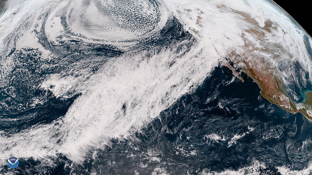
Photo: NOAA (Public domain) · via Wikimedia Commons
A Super El Niño Is Loading the Sky Over California
The equatorial Pacific is running hotter than any year on record
NOAA's Niño 3.4 index climbed from 1.6°C above average in June to 2.5°C in August. The World Meteorological Organization expects that anomaly to approach 3.7°C between October and December, past the 2.6°C mark set during the 2015-16 event. Daniel Swain, a climate scientist at the University of California's Agriculture and Natural Resources division, puts the latest weekly Oceanic Niño Index at plus 3.3°C, against a prior record of 2.1°C. NOAA's Climate Prediction Center kept its El Niño Advisory on October 8 and gave an 83% chance that the October-December Relative Oceanic Niño Index reaches at least plus 2.5°C, a level no event in its record dating to 1950 has hit.
The outlook: a wetter south, a warmer north
The outlook released October 15 covers December 2026 through February 2027. It favors above-average temperatures across the northern tier and above-average precipitation from California east to Florida and up the Eastern Seaboard, with drought improving or ending across the Southwest, the southern Great Plains and the Southeast. "A very strong El Nino will likely bring a southward and eastward shift to the jet stream," said Ken Graham, director of the National Weather Service. For California, the governor's office puts the odds above 90% for a very strong event and at 75% for one of historic strength.
The first atmospheric river may arrive in mid-November
The delivery mechanism is the atmospheric river, a narrow plume of moisture riding the jet stream from around Hawaii, better known as the Pineapple Express. AccuWeather's Alex DaSilva told USA TODAY the first could show up as early as mid-November, with January and February the most frequent months. Swain is more cautious about October: "I'll be surprised if we see anything."
Forecasts put California rainfall at 150 to 200 percent of normal
New seasonal guidance points the same way. The North American Multi-Model Ensemble calls for above-normal rain across California from December through April, and the European Centre for Medium-Range Weather Forecasts suggests San Francisco and other parts of the state could see twice the normal rainfall from December through at least February.
Warm water slides east, California takes the hit
During La Niña, trade winds pile sun-warmed water against the western Pacific, lifting sea level there by as much as 20 centimeters. When those winds slacken or reverse, the warm pool slides east. Right now the strongest anomalies sit closest to South America, the configuration of 1982-83 and 1997-98, both of which soaked California. That warm water also travels north as coastal Kelvin waves at 5 to 6 miles per hour, raising sea level by inches to about a foot.
Coastal towns meet the ocean first
Along central and southern California, Kelvin waves add 6 to 12 inches to sea level. Alviso, the San Francisco Embarcadero, parts of Marin County's shoreline and beaches in Santa Cruz have been flagged for higher-than-normal water. National Geographic notes that even 2 to 4 inches of extra sea level roughly doubles flood risk in low-lying places, and Climate X estimates coastal erosion risk in California rises by more than two-thirds during extreme El Niño years.
Burn scars turn rain into debris flows
Scripps Institution of Oceanography lists Malibu, Seal Beach, Oceanside, Encinitas, Carlsbad and Del Mar as exposed to severe beach erosion and high surf; downtown Los Angeles, San Francisco, Santa Rosa and Chula Vista to flash flooding; hillside communities such as Monrovia to mudslides. A single storm can drop up to a foot of snow on the Sierra Nevada.
Snowpack is the state's biggest reservoir
The Sierra snowpack supplies roughly one-third of California's water. The state receives about 200 million acre-feet of rain and snow a year while its reservoirs hold 50 million acre-feet, so the rest depends on aquifers. That is why too much water is its own problem: Lake Mead and Lake Powell may rise, but a full reservoir does not stop a flood.
Sacramento started in September
Governor Gavin Newsom declared a statewide emergency on September 21. The Department of Water Resources has stockpiled supplies at 68 locations: 4.4 million sandbags, more than 52,000 feet of portable Muscle Wall barriers and 400,000 tons of rock for levee repairs. Thirteen local fire departments received swiftwater rescue vehicles and boats. Residents are being told to sign up for local alerts, check their flood zone, and stage sandbags and an evacuation plan.
2015-16 is the cautionary tale
The two strongest analog years, 1982-83 and 1997-98, delivered roughly double the usual rainfall along the Southern and Central California coast. But 2015-16 was also forecast wet and came in below average statewide. Of seven winters when the relative Niño index topped 2.0, three ended with below-average precipitation and snowpack, according to the state Department of Water Resources. "The odds of an average winter are very low," Swain said, low rather than zero.
The bill runs to billions
Climate X models $2 billion to $3 billion in statewide flood and mudslide losses this winter, against a Climate Central estimate of about $500 million in typical annual flood damage. Allianz Research puts the global output loss from this El Niño at roughly $451 billion in 2027, with about $91 billion of that in the United States.
Peaks in December, the rain in January and February
El Niño is expected to peak between late November and January, most likely in December. The rain peak comes later, in January and February. For California the question is not whether it rains, but where and how fast.
Sources
- USA Today
- NOAA
- ABC News
- The Guardian
- Bloomberg