Champi Tops the Planet at 296 km/h and Bears Down on Taiwan
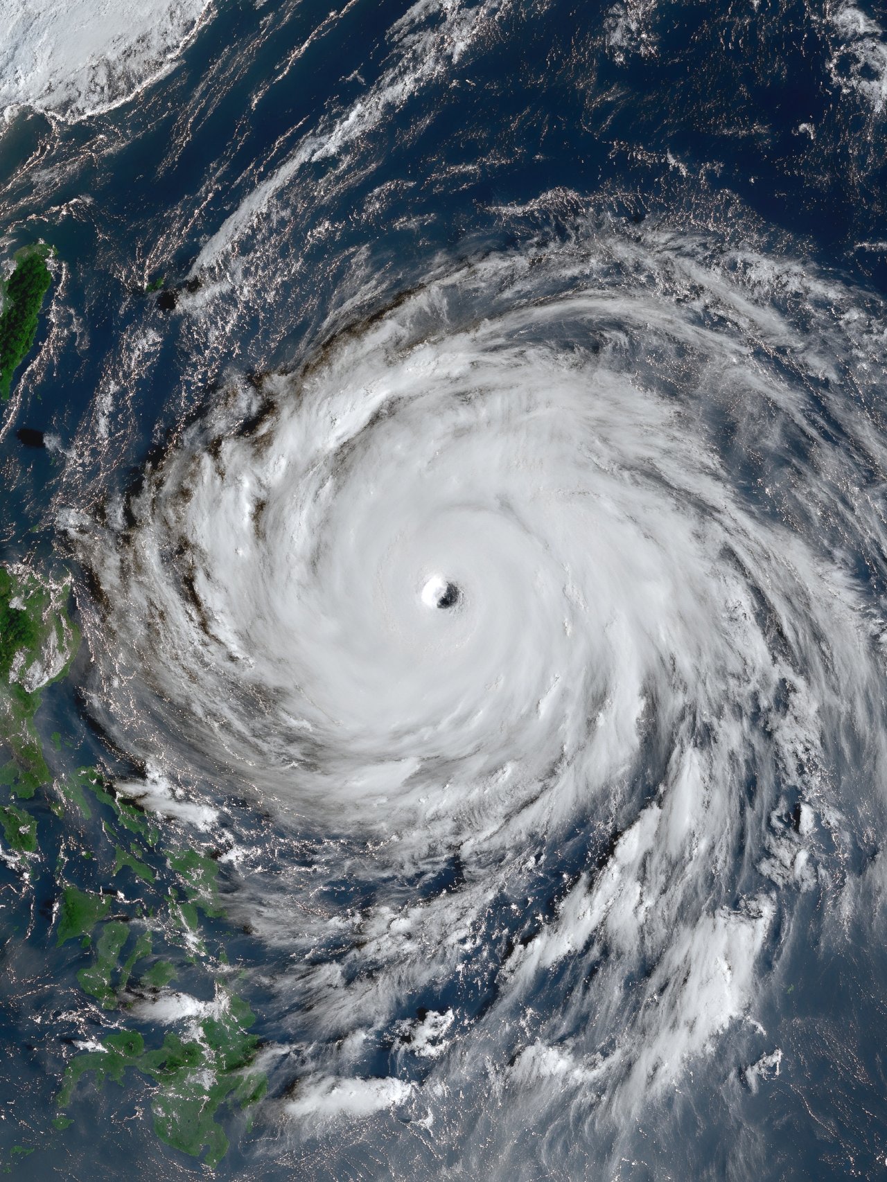
Photo: University of Wisconsin-Madison, Space Science and Engineering Center / JMA Himawari-9 satellite · via Wikimedia Commons
Champi Tops the Planet at 296 km/h and Bears Down on Taiwan
Peak Winds Hit 296 km/h, Strongest of 2026
Super Typhoon Champi became Earth's strongest storm of 2026 by wind speed on October 20, with peak sustained winds of 296 km/h, equivalent to a Category 5 hurricane. CNN called it the strongest storm to form on the planet this year. It passed Hurricane Polo, the prior record holder at 285 km/h. By minimum pressure Polo is still deeper at 892 millibars against Champi's 895 millibars, according to the International Business Times in Singapore. Yahoo, citing The Weather Network, counts Champi as the world's seventh Category 5 storm this year, forecast to weaken to Category 4 or 3 by Thursday and Friday.
Four Weather Agencies Warn at Once
The Philippine agency PAGASA, which names the system Rosal, said in its 11 a.m. October 21 bulletin that it held maximum sustained winds of 215 kph with gusts to 265 kph, centered 845 kilometers east of Northern Luzon and moving west-northwest at 25 kph. Taiwan's Central Weather Administration said a sea warning could come late Wednesday night or Thursday morning, with a land warning possible Thursday night. China's national weather agency kept a blue typhoon warning, the lowest in its four-tier system, while warning vessels and coastal areas.
Warm Water and Low Shear Fueled the Burst
The environment was near ideal. Sea-surface temperatures ran around 30 degrees Celsius, slightly above normal, according to India Today, with other tracking sites reporting 29 to 30 degrees and vertical wind shear of only 19 to 28 km/h. After an eyewall replacement cycle briefly knocked Champi back to Category 4, it quickly regained Category 5 status. Named by the Japan Meteorological Agency, Champi is its 30th named storm, making 2026 the first season to reach 30 since 2013.
Guam Lost Power, Zhejiang Readies Evacuations
Guam took the first blow. The center passed about 10 to 12 miles south of Guam's southern tip on October 17, with the northern eyewall grazing the island. About half the island lost power Sunday morning, and production wells fell from 101 online before the storm to 98 and then 78 to 87, with power demand at 52 percent on Monday, the Pacific Daily News reported. Looking ahead, Zhejiang province is preparing to evacuate vulnerable residents including the elderly and pregnant women, ferry services are suspended, and aviation data provider VariFlight flags Wenzhou, Fuzhou, Ningbo, Hangzhou, Shanghai Hongqiao, Shanghai Pudong and Xiamen airports as potentially affected, the South China Morning Post reported.
Friday and Saturday Look Worst, Turn Still Uncertain
The next test is the recurvature. Taiwan's administration expects Champi to turn northward Thursday away from the island, but Friday and Saturday will bring the heaviest impact, with heavy rain in central and northern Taiwan plus Yilan and Hualien. AccuWeather, cited by Yahoo, expects gusts to 120 mph (225 km/h) across eastern Taiwan from Thursday night, October 22, into Sunday, October 25. PAGASA sees the closest approach to Philippine land Thursday or Friday, capping the highest signal at No. 2 or 3. The Joint Typhoon Warning Center at noon Wednesday placed Champi about 600 miles southeast of Kadena Air Base with 178 mph sustained winds and 218 mph gusts, moving west-northwest.
Sources
- CNN: Super Typhoon Champi is the strongest storm of the year
- International Business Times Singapore: Super Typhoon Champi Path: Taiwan and Japan in Focus as Monster Storm Hits Category 5 Strength
- South China Morning Post: Strongest storm of the year barrels towards Taiwan and mainland China
- Focus Taiwan: Typhoon Champi's effect on Taiwan to be strongest Friday, Saturday: CWA
- SunStar: Rosal to bring heavy rains, strong winds to parts of N.Luzon